
The Purbeck Limestone Group of the Swanage Quarrying area (Lead authors: JT and WGT)
The Purbeck Limestone Group - 19th century 6” OS maps of the Swanage quarrying area.
Reproduced with the permission of the National Library of Scotland
Up to the early 20th century, limestones of the Purbeck Group were extracted from underground galleries (adits) via deep shafts. The earliest mines started with the outcrops of the Middle Purbeck on the south-facing slope above the sea cliffs. Since the First World War, when fewer men were available to work the stone by hand, excavating machines have worked opencast quarries. The Purbeck Marble and Broken Shell Limestone outcrop on the north-facing slope of the ridge and were worked similarly from those outcrops, or in shallow opencast quarries.
|
Some of the 20th century and present day quarries have been designated as Regionally Important Geological Sites (RIGS) and in 2009 Purbeck District Council asked the Dorset’s Important Geological Sites group (DIGS) to include a study of five of those sites in their Lottery Funded Keystone Project.
The initial result of that study has been published on a CD that DIGS can reproduce at a cost of £5, on application through their website www.dorsetrigs.org.uk. The geologist who measured and described the sites in detail, Paul Ensom, has published his findings in the Proc. Dorset Nat. Hist. & Archaeol. Soc.. Vol 131, 2010. |
|
|
19th century 6” OS map showing the area where the Purbeck Marble and Broken Shell Limestone were quarried from Romano-British times onwards.
|

The ‘manors’ which were the centres of quarrying are marked and are still farmsteads in the 21st century.
|
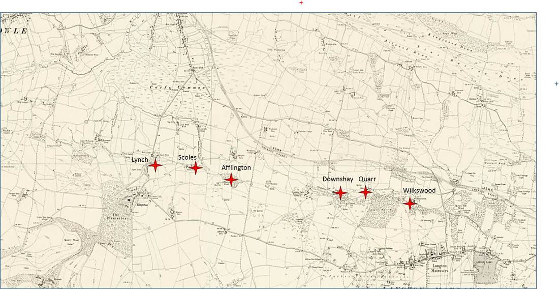
Reproduced with the permission of the National Library of Scotland. From http://maps.nls.uk/os/6inch-England-and-wales/
19th century 6” OS map showing the Broken Shell Limestone quarries in blue and the Marble quarries in red. The eastern blue quarry, near Crack Lane, is a Regionally Important Geological Site, and is accessible from a footpath from the Crack Lane cemetery
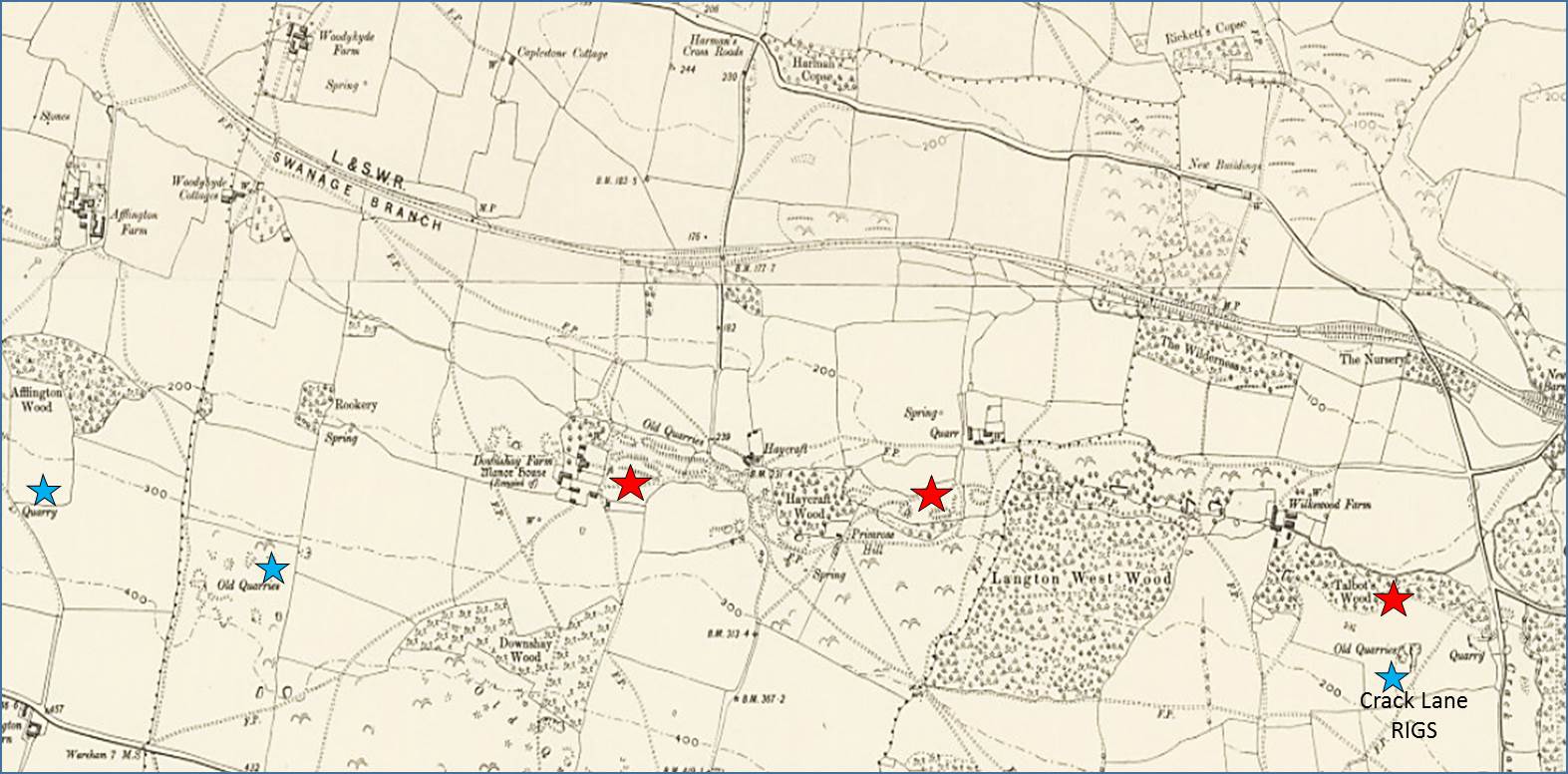
The quarry marked in Talbot’s Wood, southeast of Wilkswood Farm (just N of Crack Lane), was worked for Marble by the Romans
Reproduced with the permission of the National Library of Scotland. From their website http://maps.nls.uk/os/6inch-England-and wales/
Reproduced with the permission of the National Library of Scotland. From their website http://maps.nls.uk/os/6inch-England-and wales/
19th century 6” OS map of Acton showing the area that provided Middle Purbeck Building Stones from the Purbeck Limestone Formation Intermarine Beds. In the 19th century the stone was quarried underground (mined) and only the open shafts are mapped (highlighted by a blue bar)
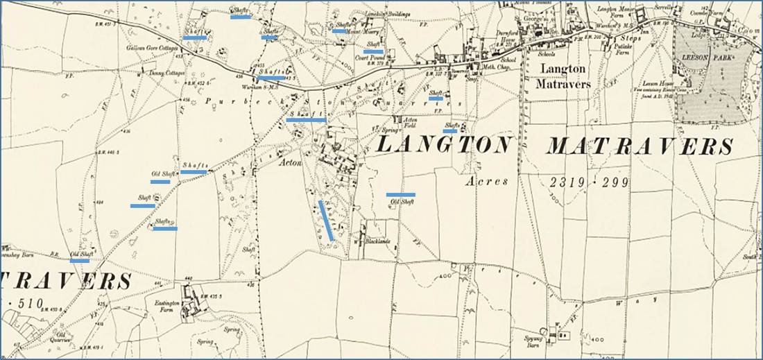
Reproduced with permission of the National Library of Scotland. From their website http://maps/nls/uk/os/6inch-England-and-wales/
19th century 6” OS map of Swanage showing opencast quarries that extracted limestone from the Purbeck Limestone Formation.
The outlined area was quarried for the Middle Purbeck Building Stones. There are also many shafts within and west of the outlined area.
The outlined area was quarried for the Middle Purbeck Building Stones. There are also many shafts within and west of the outlined area.
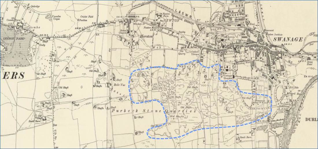
Reproduced with the permission of the National Library of Scotland. From their website http://maps.nls.uk/os/6inch-England-and-wales
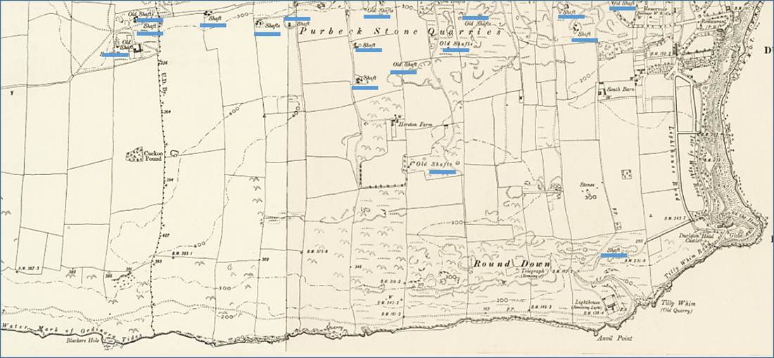
19th century 6” OS map of south Swanage, showing the shafts from which the Purbeck Limestone Formation was mined.
Portland Limestone (“Purbeck Portland” or “Cliff Stone”) was extracted from open quarries & adits at the sea cliffs from Tilly Whim in the east to St Aldhelm’s /Albans Head in the west.
Portland Limestone (“Purbeck Portland” or “Cliff Stone”) was extracted from open quarries & adits at the sea cliffs from Tilly Whim in the east to St Aldhelm’s /Albans Head in the west.
Reproduced with the permission of the National Library of Scotland. From their website http://maps.nls.uk/os/6inch-England-and-wales/